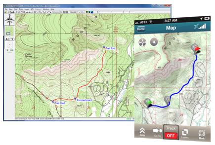
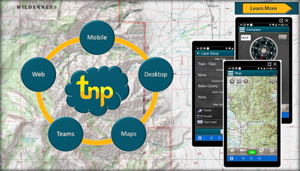
fbpx

Terrain Navigator Pro

Generating work flow efficiency and increasing return on investment for today’s mapping professionals.

Free Trial Buy now

Software platform for collaborative mapping

Trimble Forestry’s Terrain Navigator Pro is a software platform for collaborative mapping.

Subscribers gain access to a wide variety of maps, including topographic maps and satellite imagery, and map layers, such as parcel boundaries, streets, roads and trails and more, as well as an extensive set of tools and features to annotate, save, print, and export maps.

TNP-created map projects can be accessed in the field or office, from any device, and can be shared with colleagues and synced across devices.

Read more information

Free trial Buy now

Key Features & Benefits

Maps

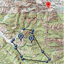
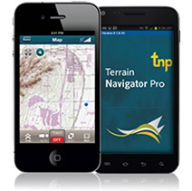
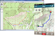
Terrain Navigator Pro; available on mobile, web, and desktop, comes bundled with USGS topographic maps, current aerial photographs, high-resolution satellite images, and street maps. You can add an optional subscription to Parcel maps, which adds private land boundaries, owner name and parcel number data to any base map.

Map Tools

Customize maps and photos with labels, marks, symbols, lines, routes, tracks, area fills, GIS data sets, and more. Use the built-in printing and publishing to create digital and paper prints with text, logos, inset maps, legends, etc. Layers, maps, and photos can be exported to be used in other GIS and CAD software or image editor.

Mobile App

You can download the TNP app to turn your smartphone into a powerful GPS device. Use the TNP mobile app to find, collect and share annotated aerial or topo maps. A mobile connection will enable you to synchronize these annotated maps with TNP desktop, or you can store the maps to download once you are back in cell coverage or WiFi. Compatible with Android and iPhone.

Web and Cloud

Synchronize maps and data between the desktop software and mobile app automatically. Push maps and projects to your mobile device, or synchronize field notes with the desktop so your field project is waiting for you when you return to the office.

Single or Multi-User Configurations

With multi-user accounts you have all the power of TNP desktop and mobile, but with added team collaboration, sharing, and multi-user project development. Track teammate positions in real time for simultaneous display on desktop and mobile devices. Annotate maps for individual or team use from anywhere whether in the field, in the office or on the go from any TNP device. Control the administrative privileges by customizing the number of users as the needs of your organization evolve.

  • “I use TNP to map, collect data, and manage a 600 acre tree farm. I map trails, gates, culverts, boundaries, and other points of interest, and am able to import GIS data created by my forester …delineating timber stands and other features. I find TNP is easy to use, much more cost effective than ArcGIS for a personal user like myself, and it works well to collect data from various sources. I’ve been using the program almost 12 years now and love all the improvements that have been made over that time.”

    Skip D.

  • “I use TNP to map, collect data, and manage a 600 acre tree farm. I map trails, gates, culverts, boundaries, and other points of interest, and am able to import GIS data created by my forester …delineating timber stands and other features. I find TNP is easy to use, much more cost effective than ARCgis for a personal user like myself, and it works well to collect data from various sources. I’ve been using the program almost 12 years now and love all the improvements that have been made over that time.”

    Skip F.

Trimble Forestry’s Terrain Navigator Pro Mapping Platform

90-Day Subscriptions are $99.00 for access to a single State (or Region.)

Yearly subscriptions start at $240.00 per person for access to each State or Region for an entire year.
Add additional States for $240.00 per person per State/Region. Subscribe to 5 or more states for $1200 per person per year.

Read more

Free Trial Buy Now

Top